Grass over the edge, not canopy — veg-notch v2 (visual re-check)
Verdict on the two sketches
Miro's sketch poses the actual question: left — a genuine notch in the pavement with grass in it; right — a straight pavement edge with grass flopping over it, hiding the true edge line.
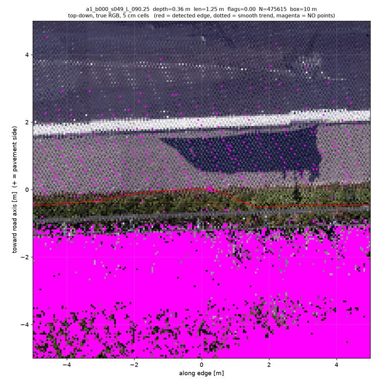
a1_b000_s049 below: grass blades
visibly lean 0.1–0.3 m over the rim, and the flat pavement surface demonstrably continues beneath the fringe
(pavement-height LiDAR returns under the blades). Seen clearly at 1 site, grazing/marginal at 3 more — always decimetre-scale.What produces deep "notches" instead: the detector leaves the physical edge entirely (lane markings, scan seams, intensity boundaries, occlusion holes) — see detector artifacts.
Percentages (v2, detector ignored)
The vegetation 10, broken down
| Sub-mode | n | Sites |
|---|---|---|
| Grass clearly overhanging pavement, pavement continuing beneath (the right-hand sketch) | 1 | a1_b000_s049 |
| Grass/verge fringe grazing the rim (≤ ~0.2 m, at resolution limit) | 3 | s032, s062, s119 (a1_b000) |
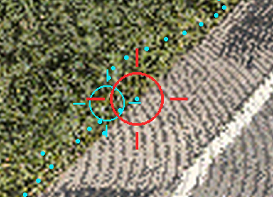
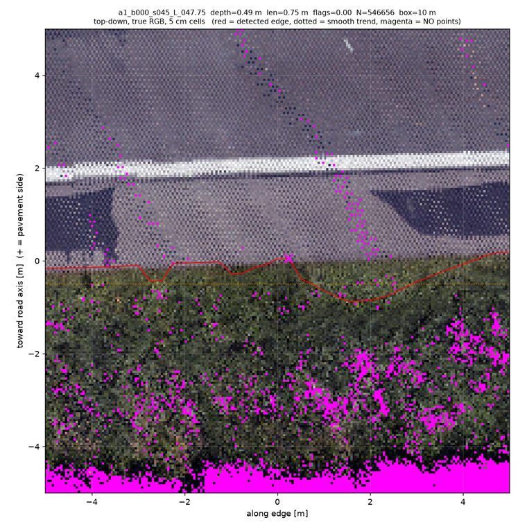
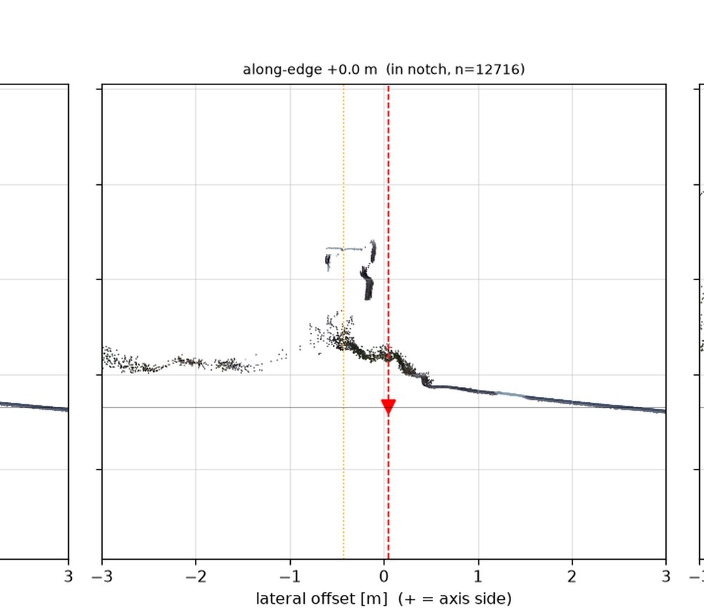
| Hedge abutting the edge, no overhang over asphalt | 1 | a1_b000_s045 |
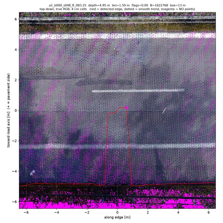
| Vegetation near edge, A2/A3 — no point cloud, unverifiable | 5 | a2_s082/s110/s137, a3_s252, a1_b000_s083* |
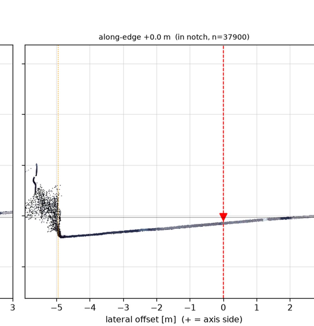
*s083: raised verge with small posts/shrub stems — vegetation present but nothing over pavement. So the direct answer to "in what percentage of the edges is vegetation overhanging?" at these notch sites: visible grass at/over the rim ≈ 15%; demonstrable overhang with pavement beneath ≈ 2–6%, always ≤ ~0.3 m. (Percentages are per sampled notch site, not per metre of edge — a per-metre sweep would need a dedicated pass.)
Real notch in the asphalt: 0 confirmed / 6 unclear / 59 no.
Grass-overhang walkthroughs (the right-hand sketch)
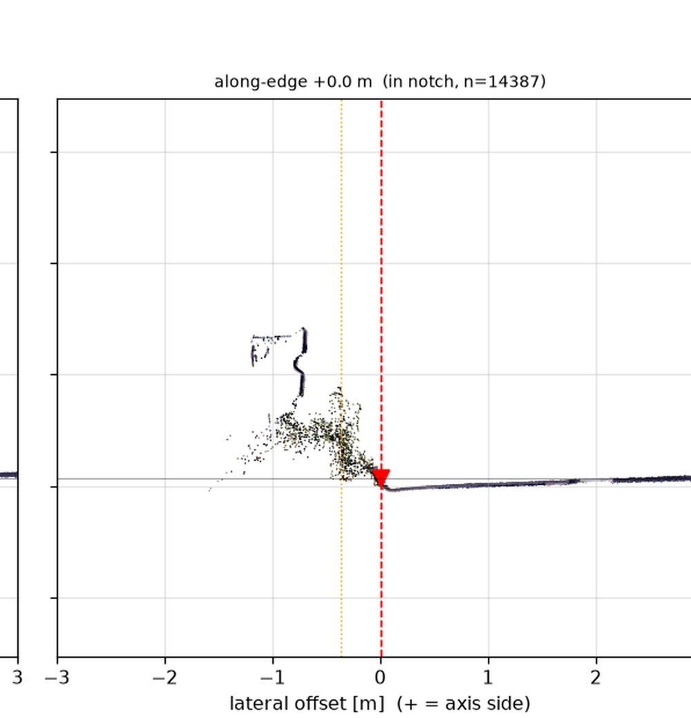
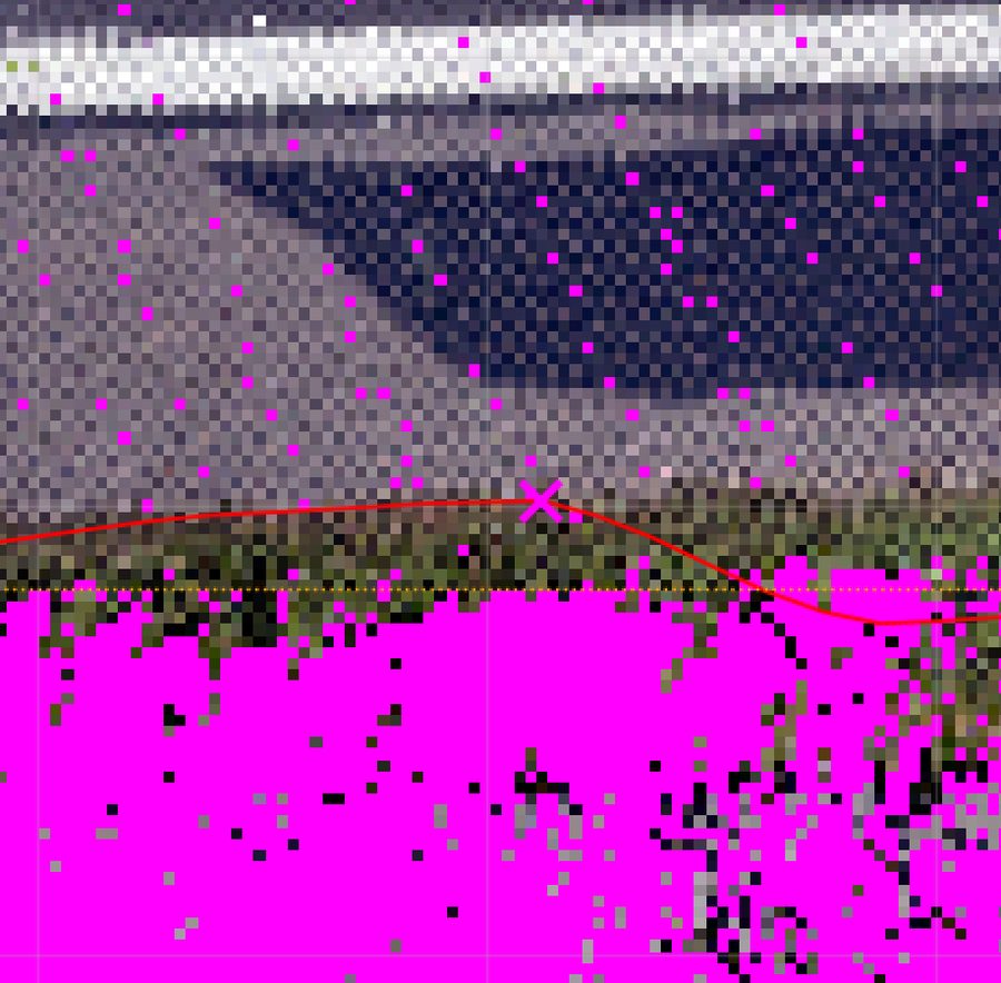
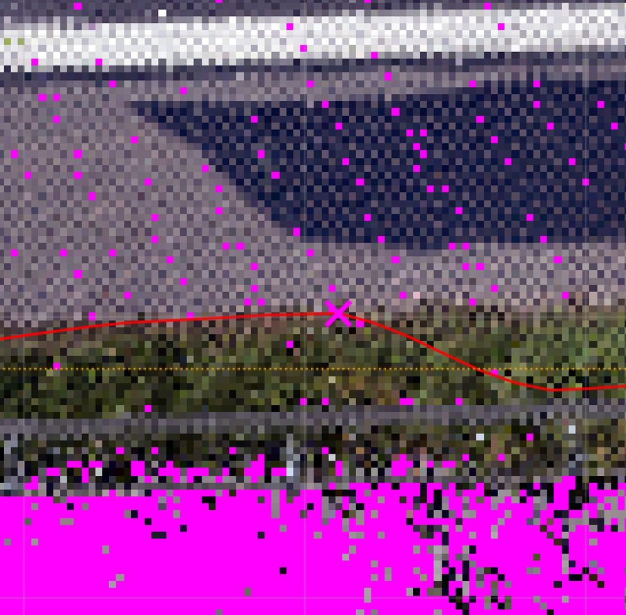
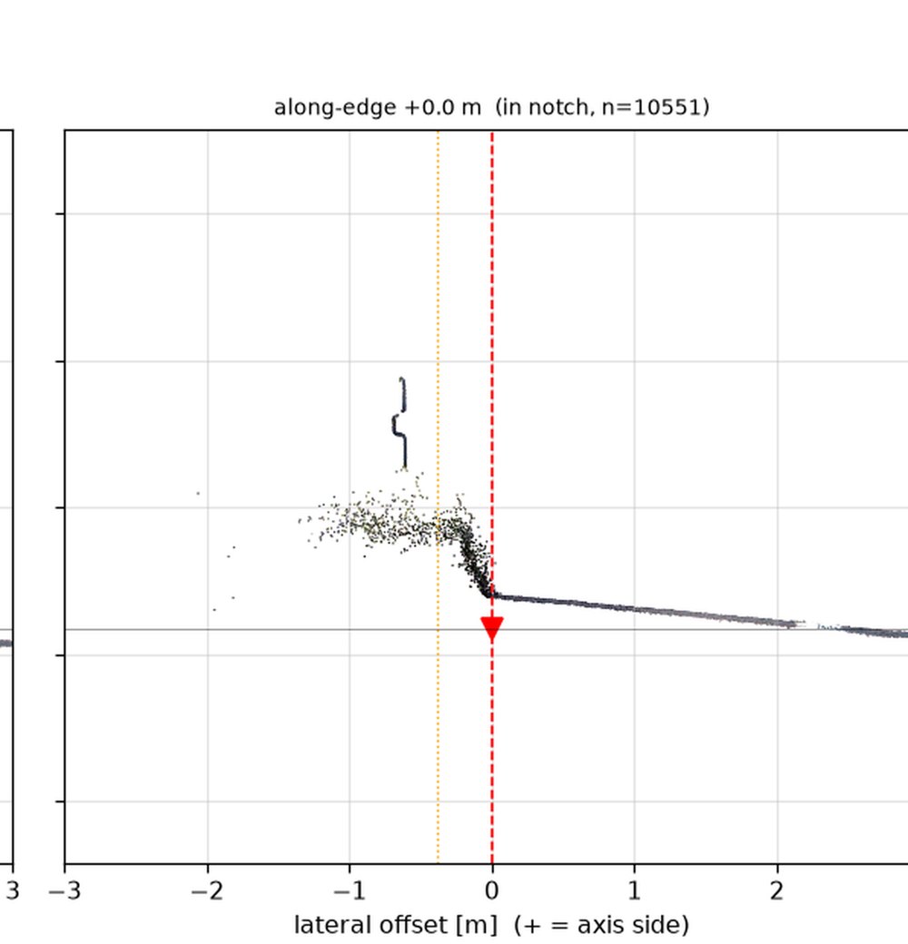
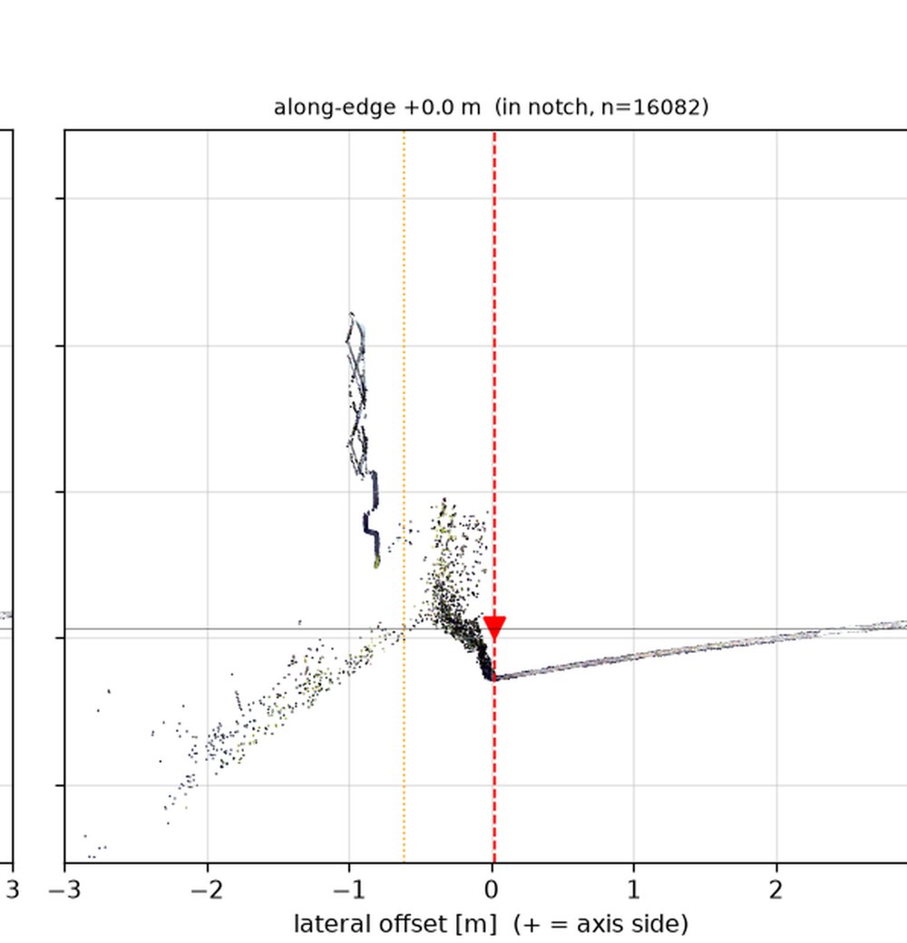
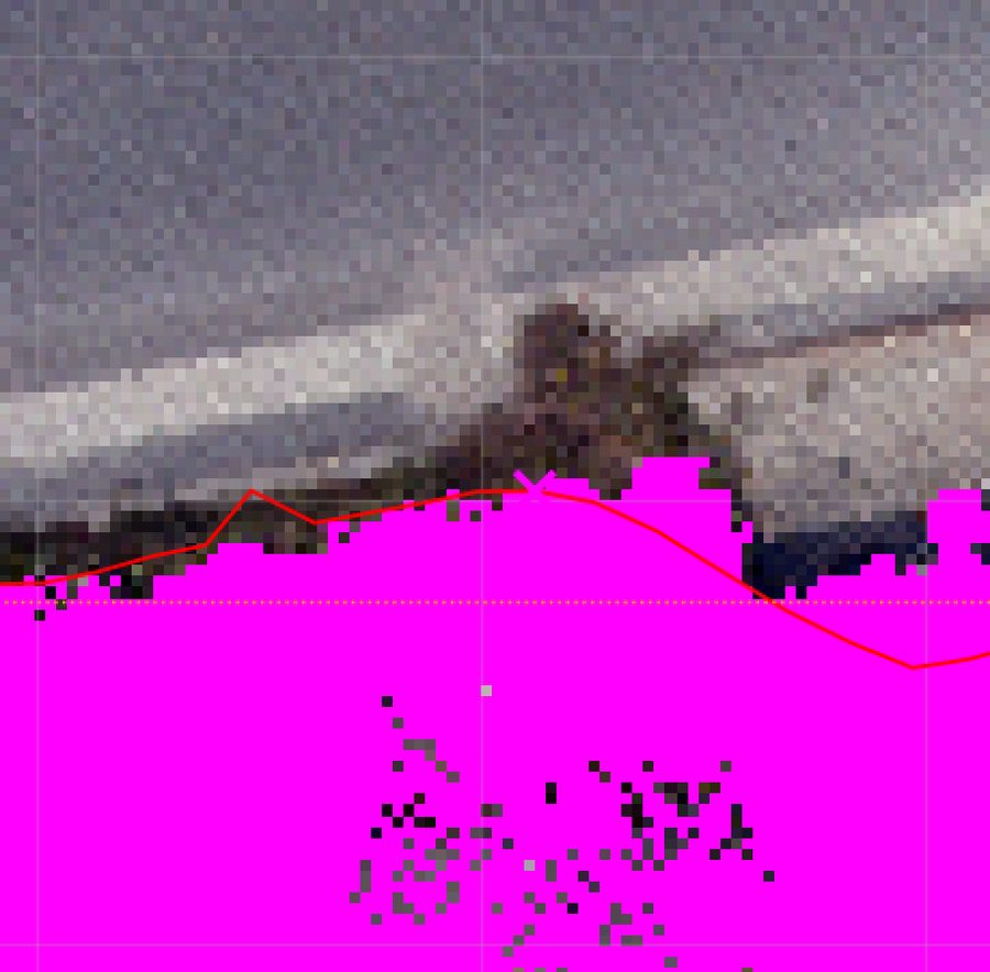
a1_b000_s049_L_090.25The clearest case in the whole sample. Perspective close-up: green blades spill from the verge onto the pale asphalt; asphalt is visible between and around the tufts. Cross-section: a ~0.3–0.4 m tall grass clump at lateral −1.5…0 whose blades arc over the rim at 0 while the flat pavement line continues straight beneath the fringe. Canopy-stripped top-down: grey pavement-level returns run right up to (and mixed into) the grass line — the edge under the grass is straight; the detected polyline (red) bulges inboard exactly over the tuft. Overhang ≈ 0.1–0.3 m over an intact edge.
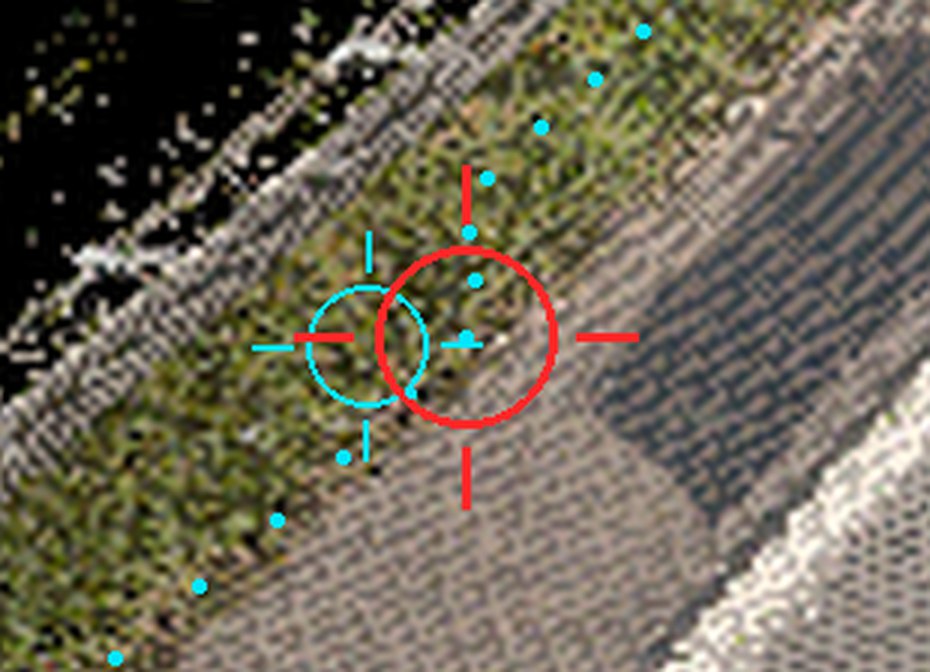
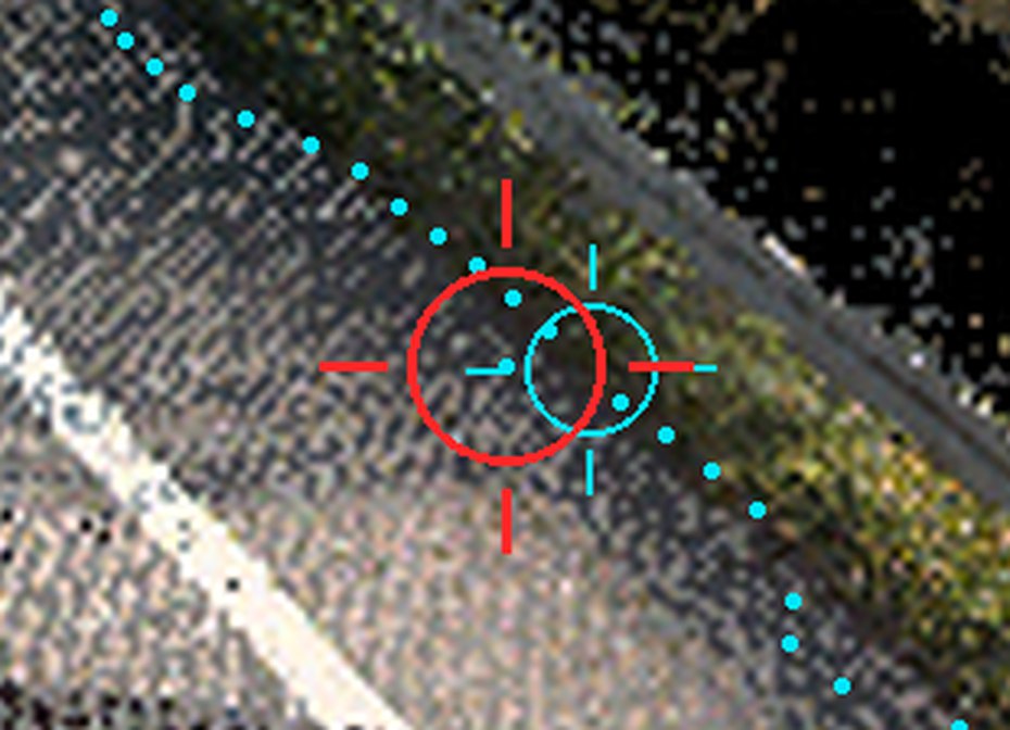
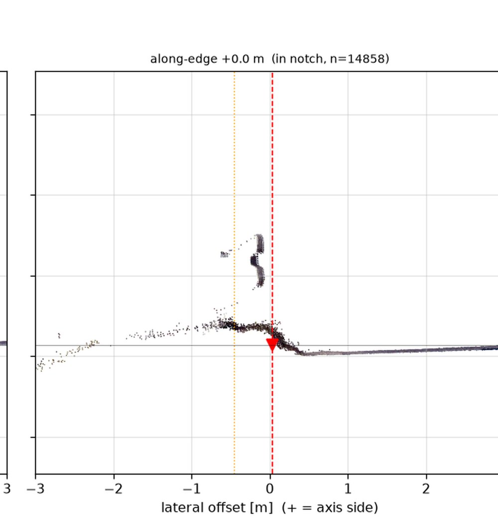
a1_b000_s062_R_058.50 · s032_R_032.75 · s119_L_019.75The recurring A1 pattern: a raised grass verge ramps up 0.15–0.3 m directly from an intact pavement edge; tufts lean onto the last decimetres of asphalt but nothing hangs clear of it. In s032 the pavement genuinely ends at the rim with a step-down to an embankment — grass sits above the rim, but there is no hidden asphalt beneath (v1's "pavement under canopy = yes" was wrong here). In all three the asphalt edge itself is straight; the notch is the detector reacting to the occluded/raised verge.
Abutting, not overhanging
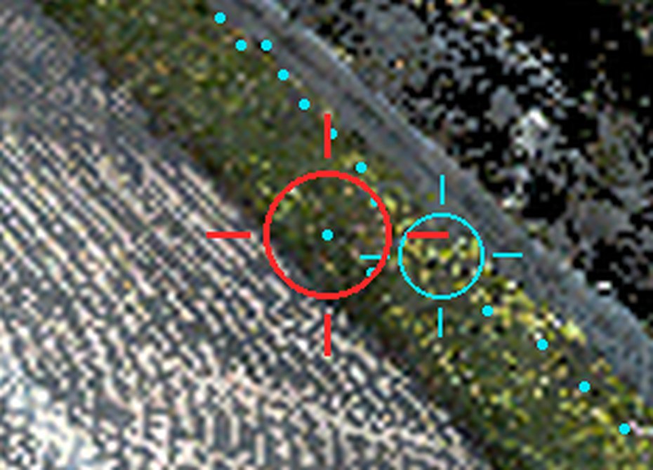
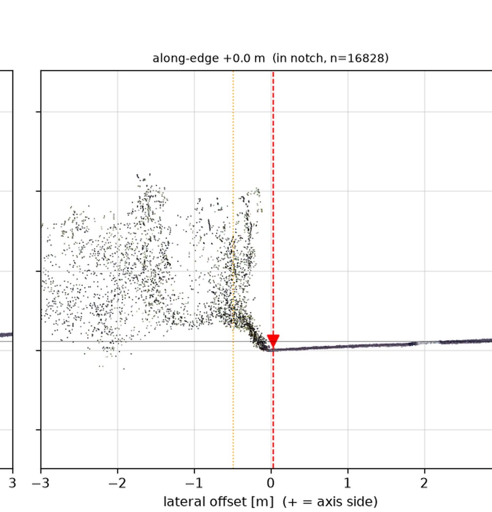
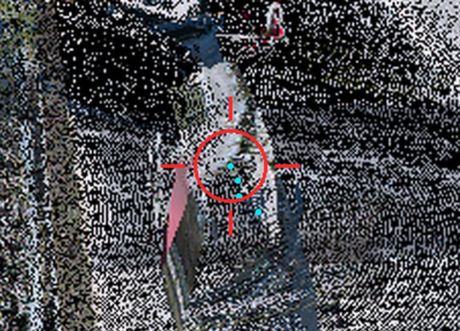
a1_b000_s045_L_047.75 · and s083_R_082.00, a3_s110_R_028.50The counterexamples that killed the "canopy overhang" reading. s045: a ~1 m hedge is massed against the edge, but its foliage stops within ~0.1–0.2 m of where the asphalt ends — it abuts the rim, it does not reach over the roadway, and there is no pavement continuing under it (verge grass, then nothing at pavement level). s083: raised rough verge with a couple of narrow ~0.5 m posts/shrub stems. a3_s110: the "vegetation" at the candidate is actually a road-sign panel on a post — an object.
Detector artifacts — the dominant mode (66%)
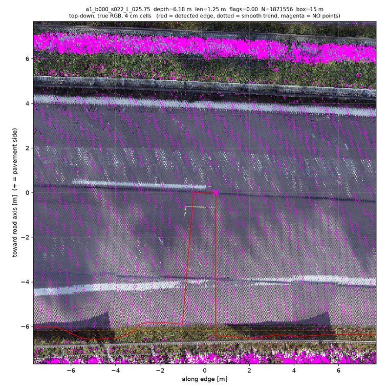
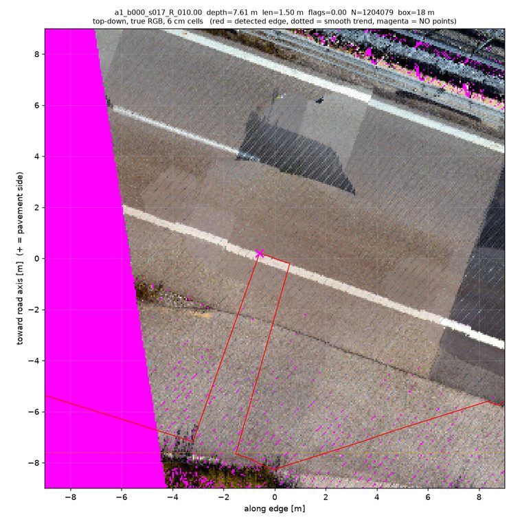
Typical members of the 43: the polyline detours across intact carriageway (rectangular excursions onto lane markings/scan seams), or wanders through a paved apron / gravel shoulder where no edge exists. Nothing at these locations resembles either sketch — the asphalt is simply continuous where the "notch" is drawn.
Method & caveats
- Who looked: Fable personally judged 9 sites and re-verified every disputed positive; 12 Opus vision judges covered the rest (2–3 evidence images each); every veg/notch positive got an adversarial second pass that tried to refute it with pixel-calibrated measurements. Detected-edge overlays were explicitly excluded as evidence throughout.
- Voxelization / point density: the renders draw the raw
lane_pointsnpz points — no voxel downsampling in the render scripts (only the 3D-oblique view subsamples, to 300k, and it was not used for verdicts). Density at the featured sites is ~5–8k pts/m² (≈6–8 cm spacing), so individual grass blades are partially sampled: centimetre-scale blade overhang is likely underestimated. Decimetre-scale overhang (what the notches would require) would be visible — and isn't, except as documented above. - Perspective close-ups are point-rendered views (1600×900, topmost aggregation) from ~20 m; at that range ≈3.5 cm/pixel — grainy but sufficient to see tufts vs asphalt. If npz clouds were decimated upstream of this repo, the same "underestimates thin blades" caveat applies.
- Sample bias: the 65 sites were sampled from detected notches (depth ≥0.3 m), so all percentages are per notch site. The share of total edge length with grass overhang is a different number and would need a dedicated sweep along the whole edge.
- A2/A3 have no point clouds; their 5 vegetation calls rest on perspective/raster views only and stay unverified. A2 RGB renders are white (depth-only evidence).
Data
- Evidence per site:
output/vegnotch/cand_<id>/· reading guideoutput/vegnotch/ADJUDICATION_GUIDE.md - v2 verdicts (60 workflow-judged + verify):
/tmp/wf_verdicts.json· Fable's own notes:/tmp/vegcheck_notes.md - v1 (superseded on the 25%/18% split): veg-notch-report-20260801 · candidates/population:
output/vegnotch/candidates.json,population.json